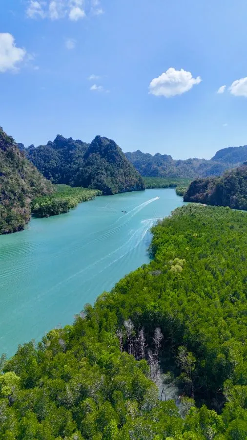
A boat-paced route through Langkawi's UNESCO-listed Kilim Karst Geoforest Park - a bat cave, mangrove channels, a floating fish farm and eagles overhead, ending at a limestone pinnacle 250 million years in the making.
Play interactive tourPart of Langkawi's UNESCO Global Geopark since 2007, this 100-square-kilometre estuary of mangrove forest and limestone karst is reachable only by boat - one of the last true wildernesses left on the island.
Every Kilim tour starts here, at the jetty where flat-bottomed boats push off into the mangrove channels - the only way in or out of the geoforest park.
A short detour from the jetty, this limestone cave reached by boardwalk is home to colonies of fruit bats roosting in the dark - one of several karst caves carved into Kilim's ancient Permian limestone.
Back past the jetty, stilt-rooted mangrove trees line the channels here, filtering the tide twice a day and sheltering otters, monitor lizards and mudskippers in a forest that's half land, half sea.
Further up the channel, cages moored in the estuary hold groupers, horseshoe crabs and stingrays for visitors to see up close - a floating stop that doubles as a crash course in the mangrove's marine life.
Langkawi takes its name from the Malay word for eagle, and nowhere is that more visible than here - Brahminy kites and white-bellied sea eagles wheel low over the water, drawn in by boat operators tossing out fish.
A single limestone pinnacle rising sheer from the estuary, once seabed sediment compressed over hundreds of millions of years - closing shot of the tour, and one of Kilim's most photographed formations.